June 28, 2026
South-East Asia Satellite Images and Political Maps
[Travel Photo Gallery] [Great Circle Distances] [Asia Maps and Views][Singapore] [Bangkok] [HK & Macau, Penang, Phnom Penh & Siem Reap] [Sydney, Hanoi & Hai Phong, Bali ]

|
(Contact Hugh Webb for comments.)
|
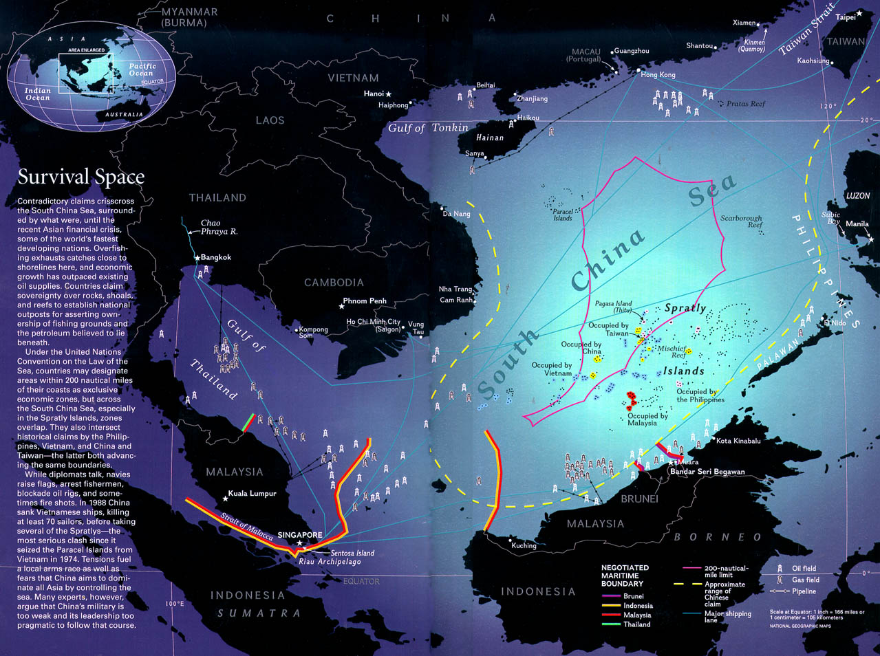
South China Sea Map (1279x954) |
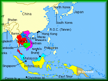
Larger Political Map, Southeast Asia (867x685) |
Satellite views of selected locales within South-East Asia
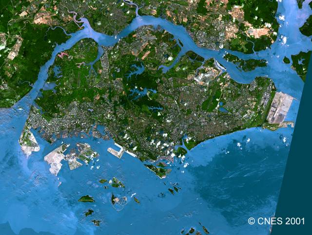
Singapore Map & Satellite Views
|
Bangkok - Grand Palace and surrounding area
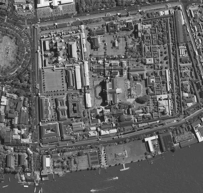
Grand Palace, 2001 (DigitalGlobe) |
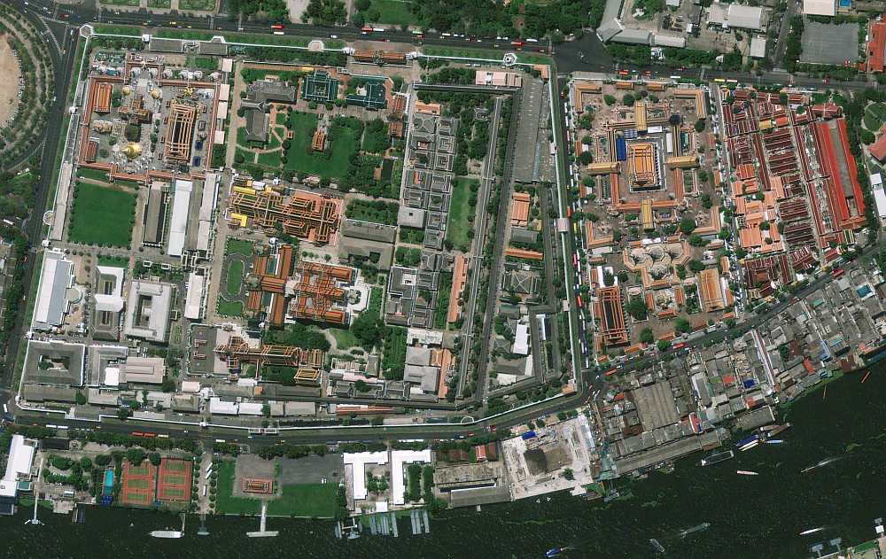
Grand Palace and Wat Po, 2009 (GeoEye) |
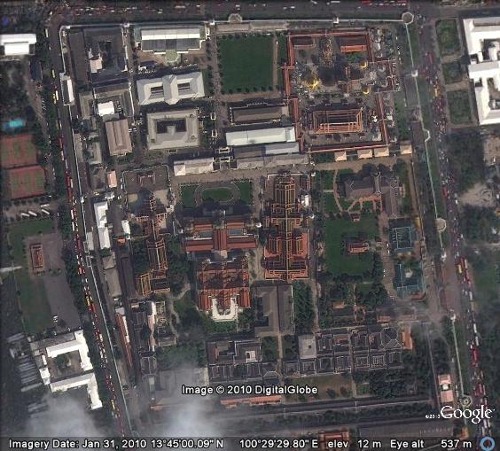
Grand Palace, 2010 (DigitalGlobe) |
Other cities in S. E. Asia
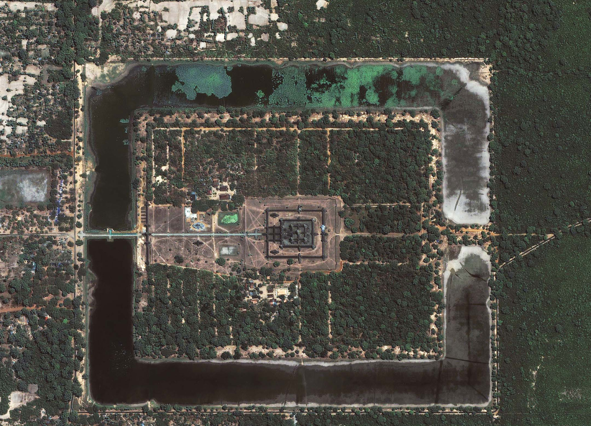
Angkor Wat, 2004 (675x474) (GeoEye) |
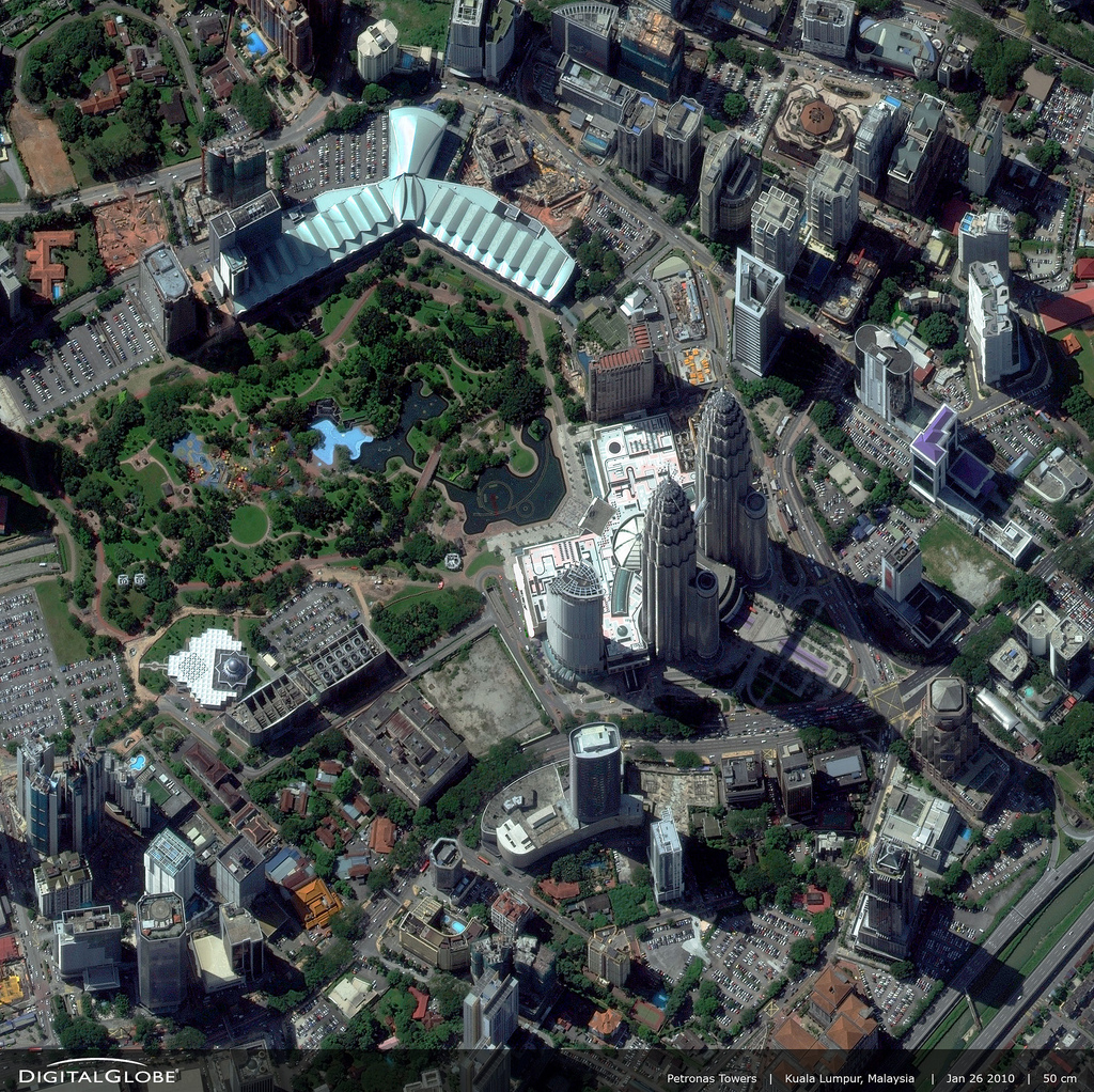
Petronas Towers, KL, 2010 (1024x1022) (DigitalGlobe) |

Hong Kong (2000x2000) (GeoEye) |

Shwedagon Pagoda, Yangon (1024x1020) (DigitalGlobe) |
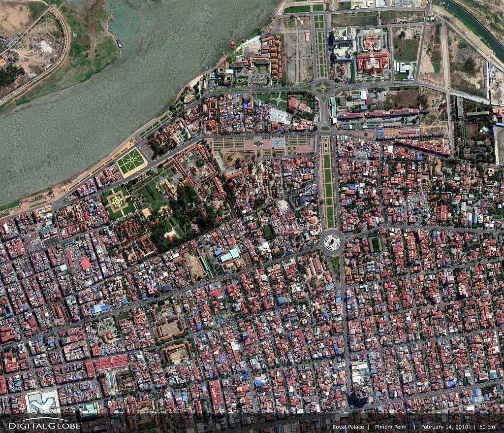
Phnom Penh (1024 x 879) (DigitalGlobe) |
|
Hong Kong and Macau
|
Pulau Pinang (Penang)
|
Phnom Penh and Siem Reap (Angkor)
|
|
Sydney |
Hanoi and Hai Phong |
Bali |
Edit